Maps
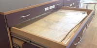
One of the more valuable collections we have in the Reference Library is the Historic Map collection. Maps can be one of the most useful resources for local and family historians, detailing the development of towns, roads and buildings, the location of long gone neighbourhoods and the changing nature of boundaries and old place names. We have two map chests for storage and viewing, with a detailed index to help your search.
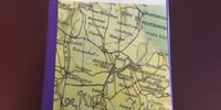
Our collection covers:
Billingham and Norton From 1775
Darlington From 1898
Hartlepool From 1861
Middlesbrough From 1857
Redcar From 1928
Stockton High Street From 1724
Stockton From 1885
Thornaby From 1855
Surrounding Villages From 1859
Yarm From 1853
To view the collection simply pop in or view our reference section of Stockton-on-Tees website.